by Sam Lawson, Earthsight
Summary:
Analysis of satellite data clearly demonstrates forest fires burning in areas undergoing conversion for oil palm in two locations in southern Papua. One of these areas is intact primary forest, while part of the other is on peat soil. The concessions concerned are both owned by the large Korean conglomerate Korindo.
It is illegal in Indonesia for companies to clear land using fire, and oil palm concession holders are also legally required to have in place appropriate fire prevention and fire-fighting measures. Though on its own the evidence below does not prove any wrongdoing by the company or its subsidiaries or contractors, it should justify further investigation by the Indonesian authorities.
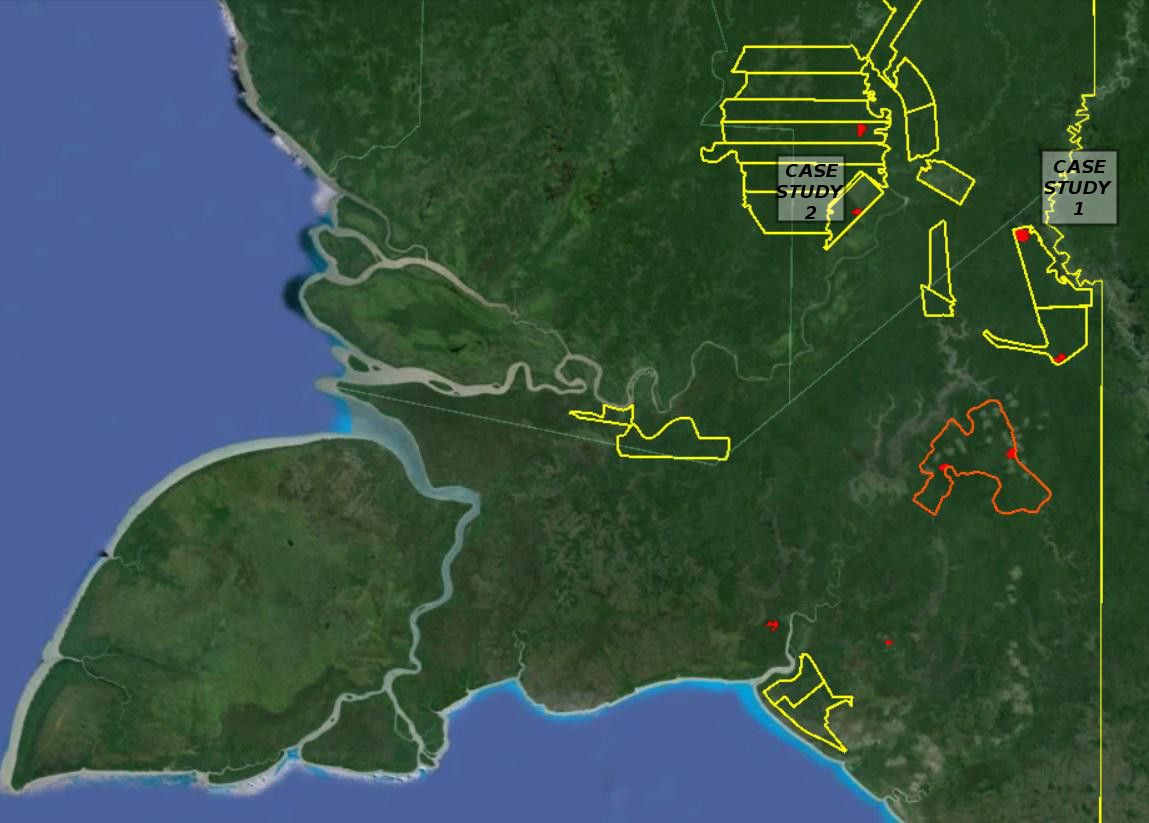
Figure 1: Southern Papua, showing boundaries of oil palm conversion concessions (yellow), forest clearance for oil palm during September-October 2015 (red) and location of case studies below.
Case Study 1: PT Papua Agro Lestari (Korindo group) (( The Linked-In page of the Assistant Manager of Plasma (Smallholder) plantation development at PT PAL identifies the company as being part of the Korindo group – https://www.linkedin.com/in/yovita-natalia-b5168882 [awasMIFEE note: previously on this site it had been thought that ownership of PT Papua Agro Lestari had been transferred to the Daewoo International Corporation. Although the situation is confusing, and there appears to be close cooperation between the two companies, several pieces of evidence indicate that the company is still part of the Korindo Group] ))
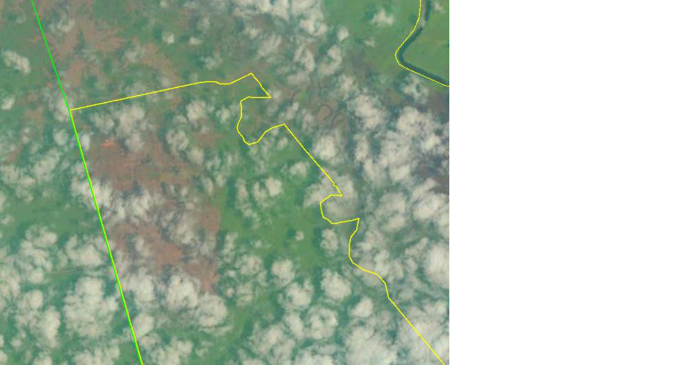
Between 1st September and 9th November 2015, more than 230 fire hotspots were detected by the NASA MODIS satellite within an area of intact primary forest undergoing plantation development near the PNG border in PT Papua Agro Lestari, Merauke district (see Figure 2).
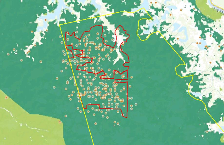
Figure 2: Fire hotspots 1st Sept – 9th Nov 2015 in PT Papua Agro Lestari (yellow boundary). Red boundary shows area of forest cleared for plantation development up to 24th October 2015. Green background shows that the area was previously intact primary forest. ((Sources: Background – Degraded (light green) and intact (dark green) primary forest, from Margono, B. Primary forest cover loss in Indonesia over 2000–2012. Nature Climate Change,doi:10.1038/nclimate2277; spots – NASA MODIS fire hotspots, “NASA Active Fires.” NASA FIRMS. Accessed through Global Forest Watch on 15th November 2015; concession boundary – Ministry of Forestry GIS portal map of Forestland releases, accessed 9th November 2015; extent of new oil palm development (red/orange line) – based on analysis of Landsat satellite images from 25/1/15, 6/9/15, 24/10/15. ))
Landsat images confirm the existence of fires within this area, and clearly show how they are related to oil palm plantation development.
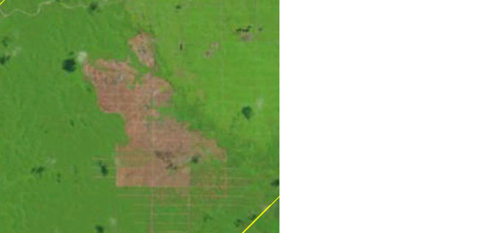
On 6th September 2015, a fire is clearly visible burning in the plantation (see Figure 4). The next cloud-free image, from 24th October 2015, also shows a fire burning, in an area which was still primary forest 7 weeks earlier (Figure 3).
In just 7 weeks between during Sept-October 2015, 1000 hectares of primary forest were cleared, a much faster rate than could plausibly have been achieved by other means.
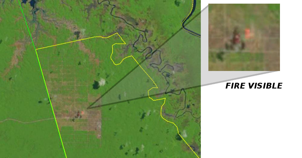
 Figures 3 & 4: Fires visible in oil palm plantation under development in PT PAL, September & October 2015
Case Study 2: PT Tunas Sawaerma (Korindo)
During the same period, more than 100 fire hotspots were recorded by the NASA satellite in an area currently being cleared of degraded primary forest for oil palm in PT Tunas Sawaerma, a concession in Boven Digoel district which is also owned by Korean conglomerate Korindo (see Figure 5).
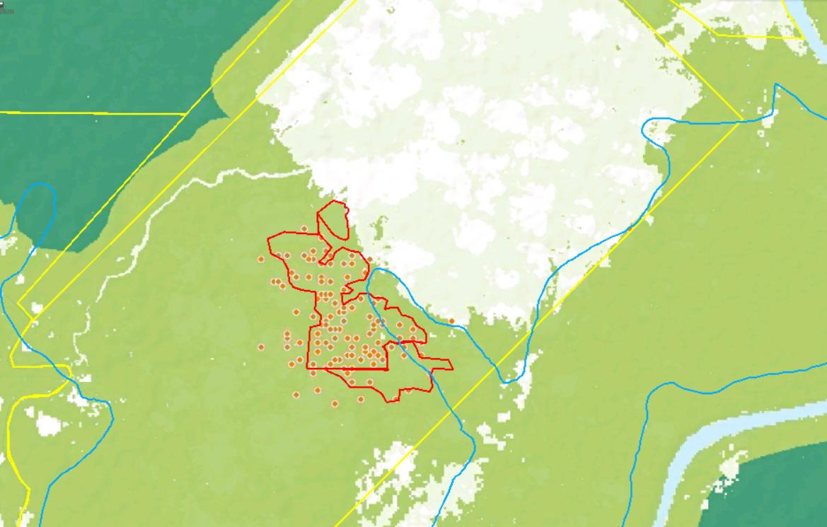
Figure 5: Fire hotspots 1st Sept-9th Nov 2015 inside Korindo’s PT Tunas Sawaerma oil palm concession (yellow). Red/orange boundary shows area of forest cleared for plantation development up to 24th October 2015. Blue line indicates peat soils. The orange boundary shows the areas cleared between 6th September and 24th October 2015 (( Sources: Peat soils – Wetlands International, 2004. For all other data see reference for Figure 2 ))
Again, Landsat satellite images confirm the existence of fires within this area of recent development. An image from 24th October clearly shows a large fire within the area under development. Comparison with an image from the beginning of September shows that the area concerned remained forested previously, though new plantation roads had been cut (see Figures 6 and 7).
Many of the fire hotspots in the Korindo concession are on peat soils, as is some of the area newly cleared by fire during September/October 2015 (see Figure 5).
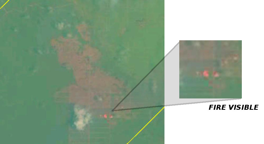
Figures 6 & 7: Fire visible in forest area in process of development into oil palm, Korindo’s PT Tunas Sawaerma. The images were taken on 6th September 2015 (figure 6) and 24th October 2015 (figure 7)